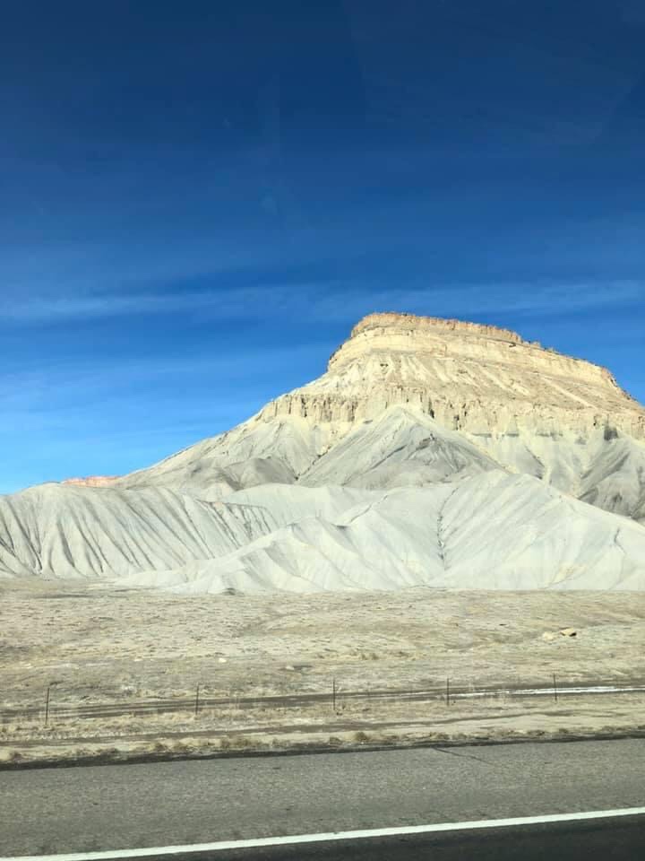
Beginning near Palisade, Colorado the Book Cliffs are a series of desert mountains and cliffs that extend over 200 miles west towards Utah. Named due to their resemblance to ‘books on a self’, the Book Cliffs are one of the main geological features of the Grand Valley. Mount Garfield, the highest point of the Book Cliffs east of Grand Junction, is one of the most popular hikes in the Grand Valley.
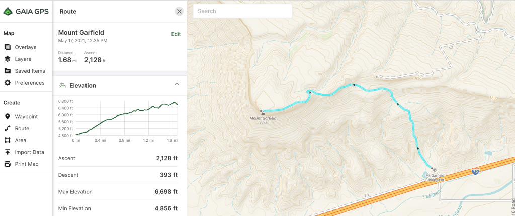
Dedicated to President James Garfield after his assassination in 1881, Mount Garfield is a short, extremely challenging hike. Ascending over 2000 feet in just 2 miles, the trail is listed as Intermediate/Difficult on the Hiking Project. We did this hike in late January and while parts of the trail were covered in snow, 90% of it was clear. I would agree with the Hiking Projects rating, as the first 3/4 mile was steep and the scramble to the summit was extremely slippery due to the snow cover.
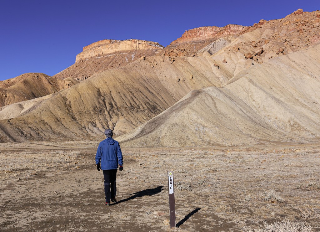
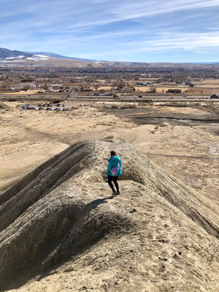
From the parking lot, Mount Garfield can be seen rising high above the Book Cliffs. We easily spotted the trail, as a marker had been placed in front of the ridge we would ascend. Upon our arrival I was a little hesitant about what we were getting ourselves into. The ridge-line looked a little aggressive and I wasn’t sure about what would lie ahead. We promised each other that we’d a least give it a shot and if it became too difficult we could always turn around and come back down.
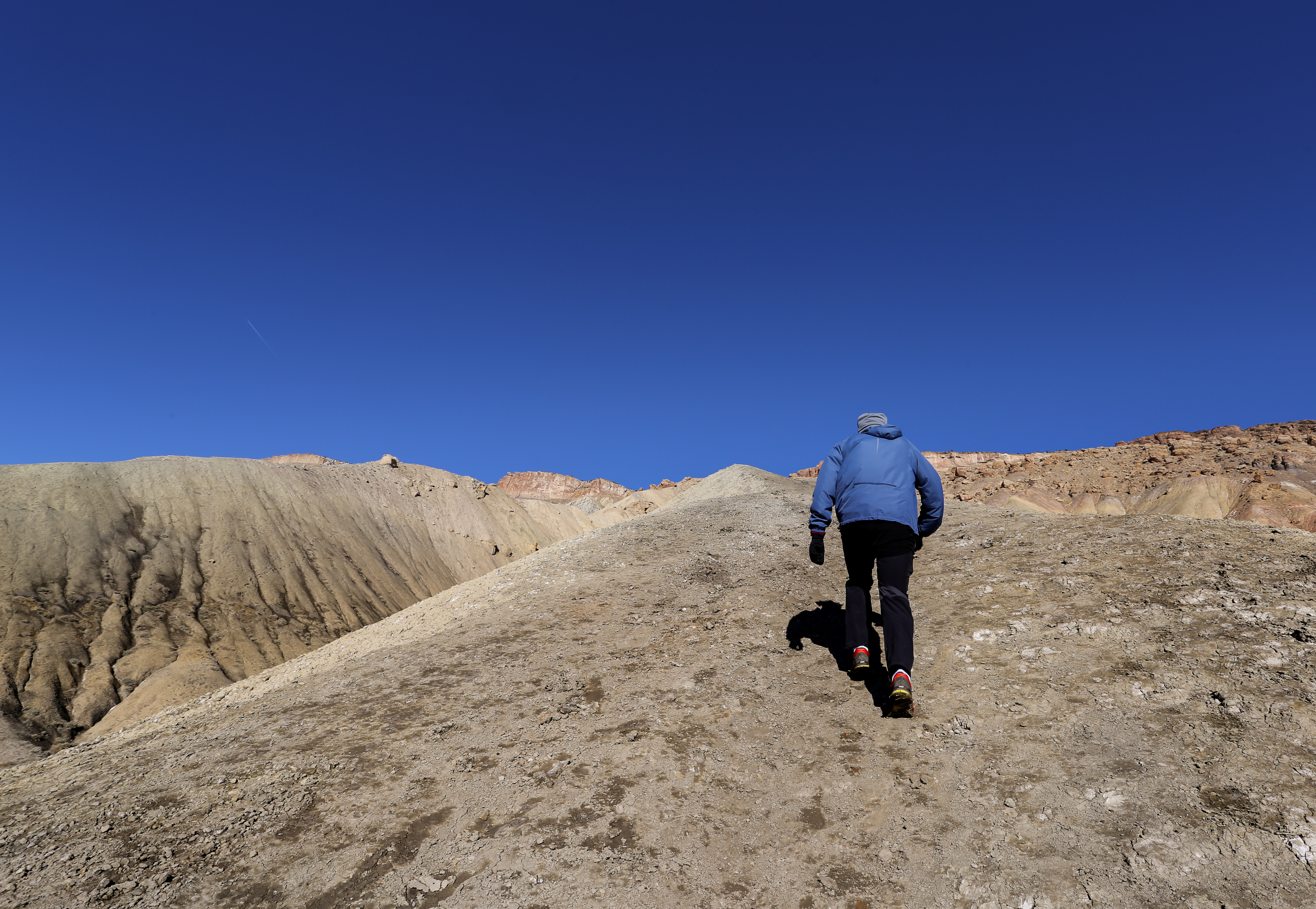
As soon as we hit the ridge the grade was steep. Every few feet we had to take a break in order to catch our breath. The ridge-line felt about a foot wide, I kept my eyes down as my peripheral vision was rippling. I have never experienced vertigo but the higher we went the wavier it got.
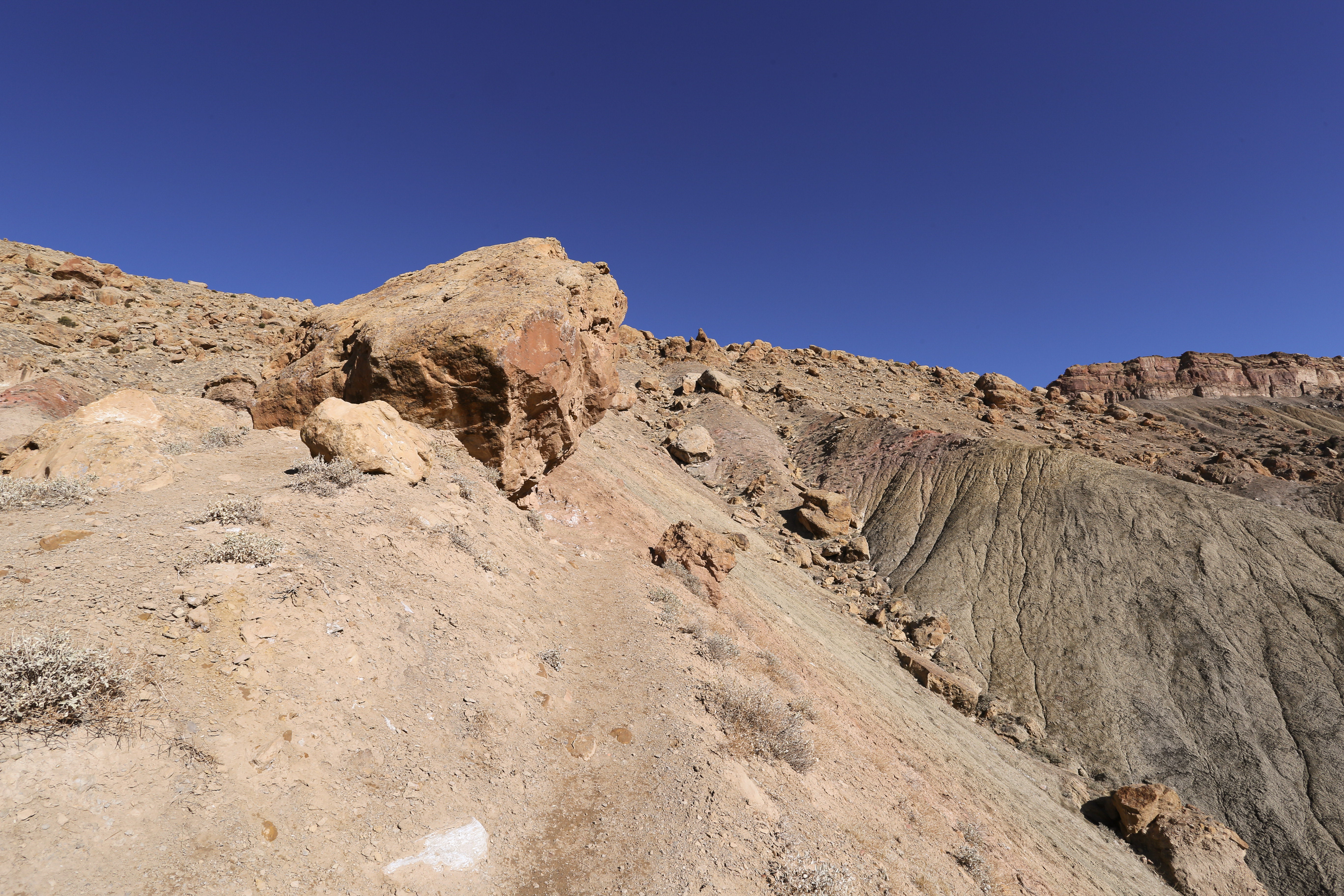
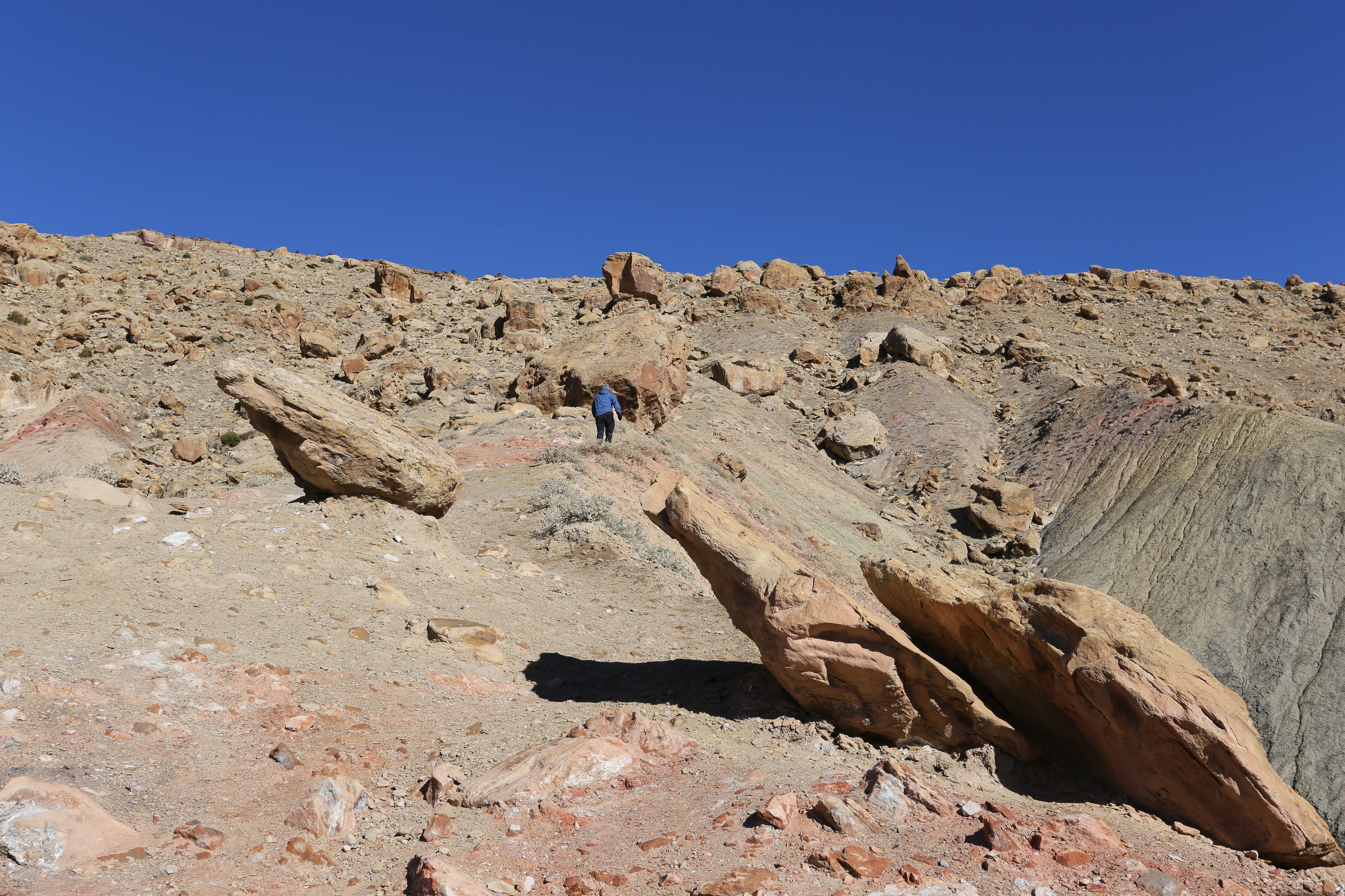
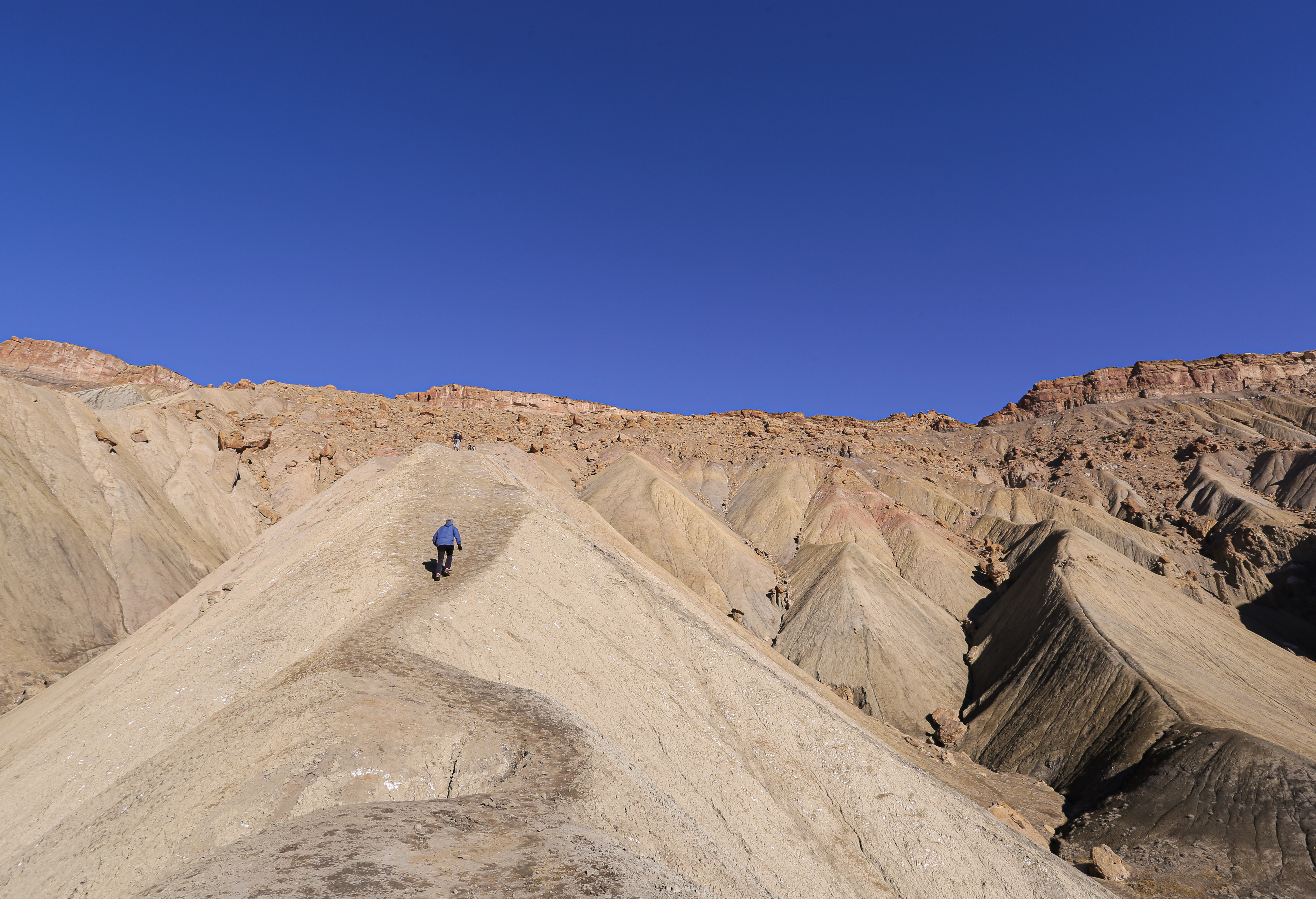
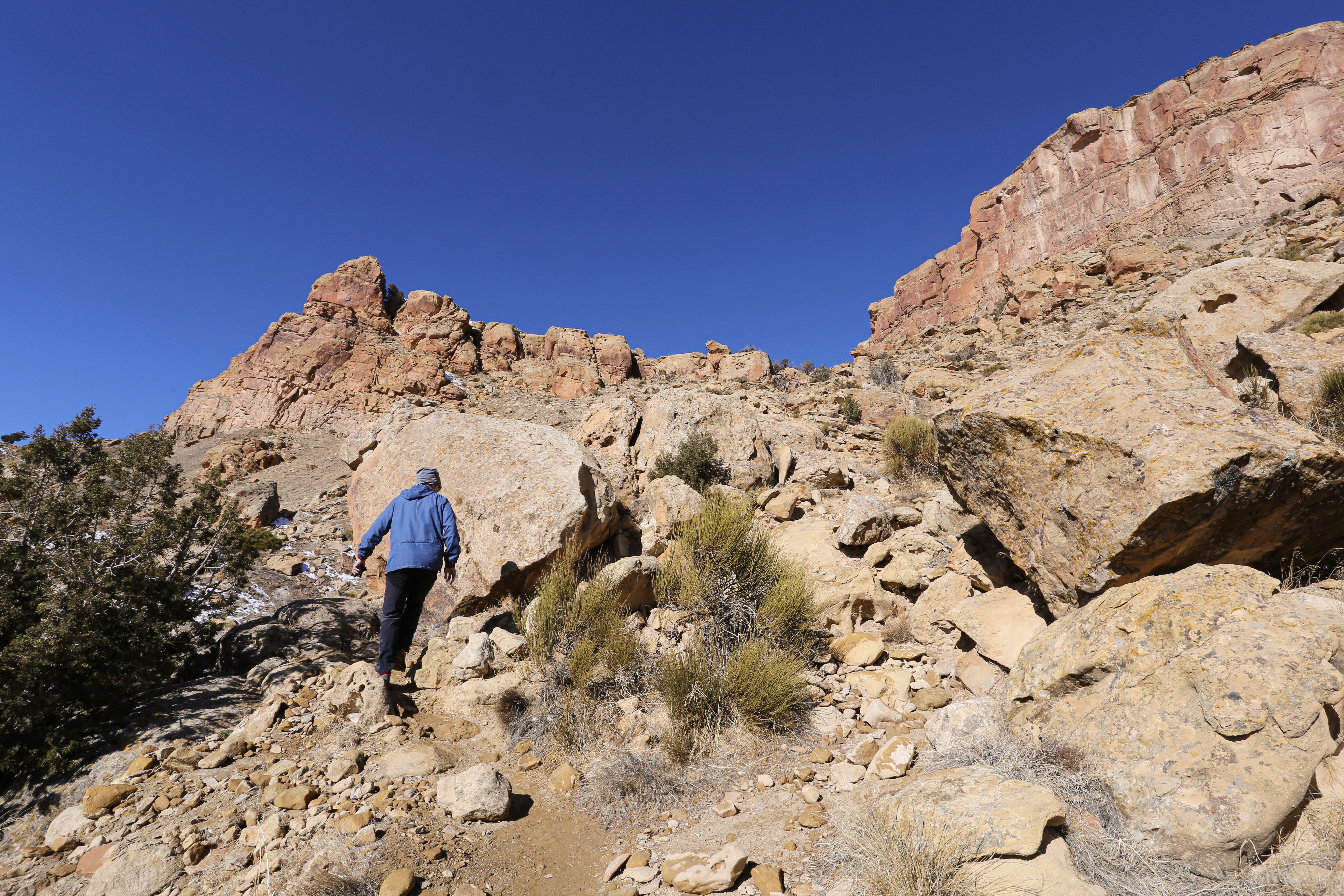
The ridge became rocky at the half mile mark. At times the trail was hard to find as we maneuvered around massive boulders. The grade was still steep but not as scary since we were no longer on a shale ridge-line. This section of the trail is what I image Mars to look like; massive boulders with reddish brown dust covering the landscape. It was wildly beautiful.
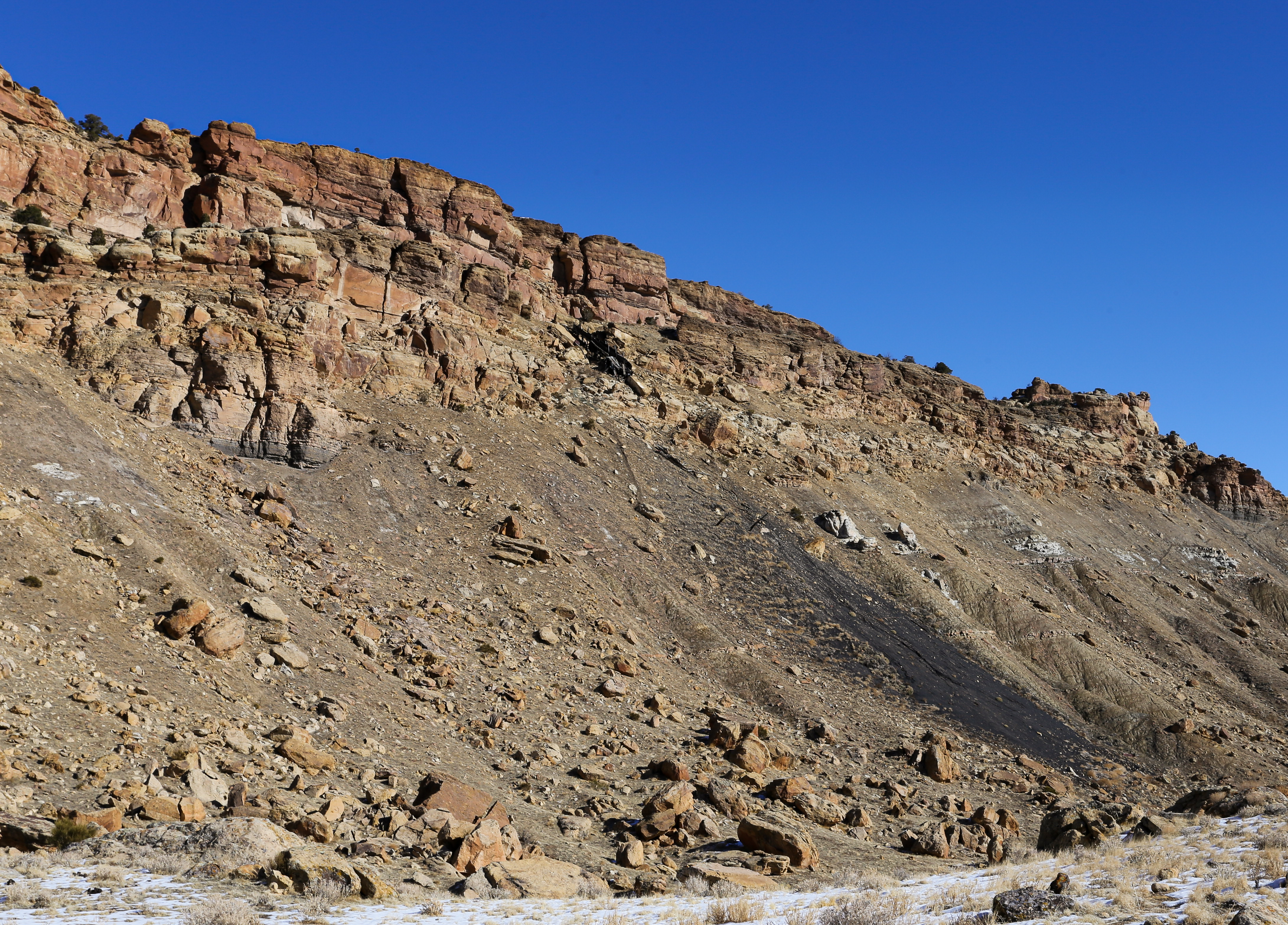
Once past the boulder field the trail flattened out as we entered a high desert meadow backdropped by an old abandoned coal mine. While researching this hike I read about how coal miners would hike up this trail every morning, put in a full days work, and then head back down at the end of the day. These men were my motivation as we made our way up the first section of the trial. From the meadow we headed West as the trail made its way towards another boulder field.
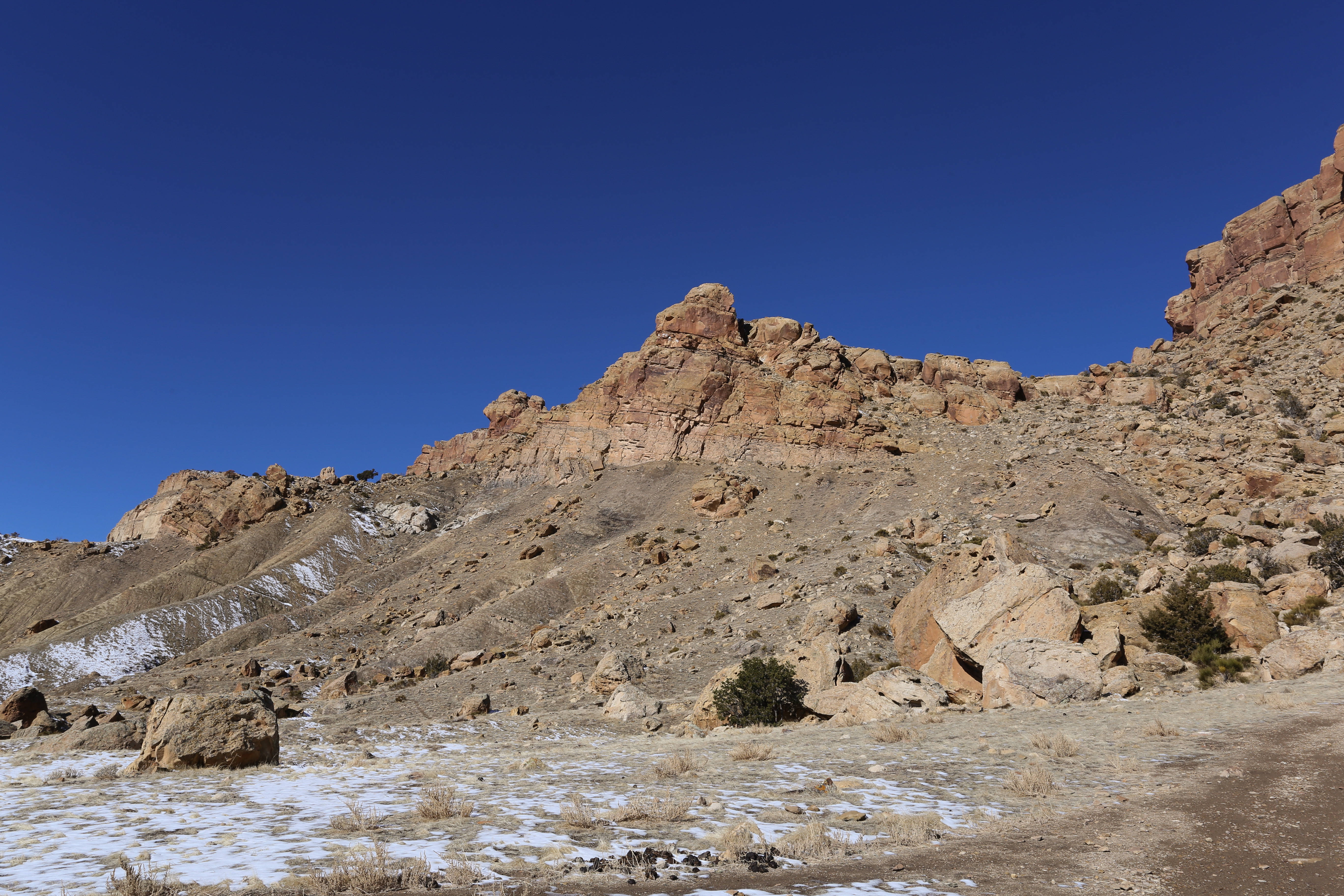
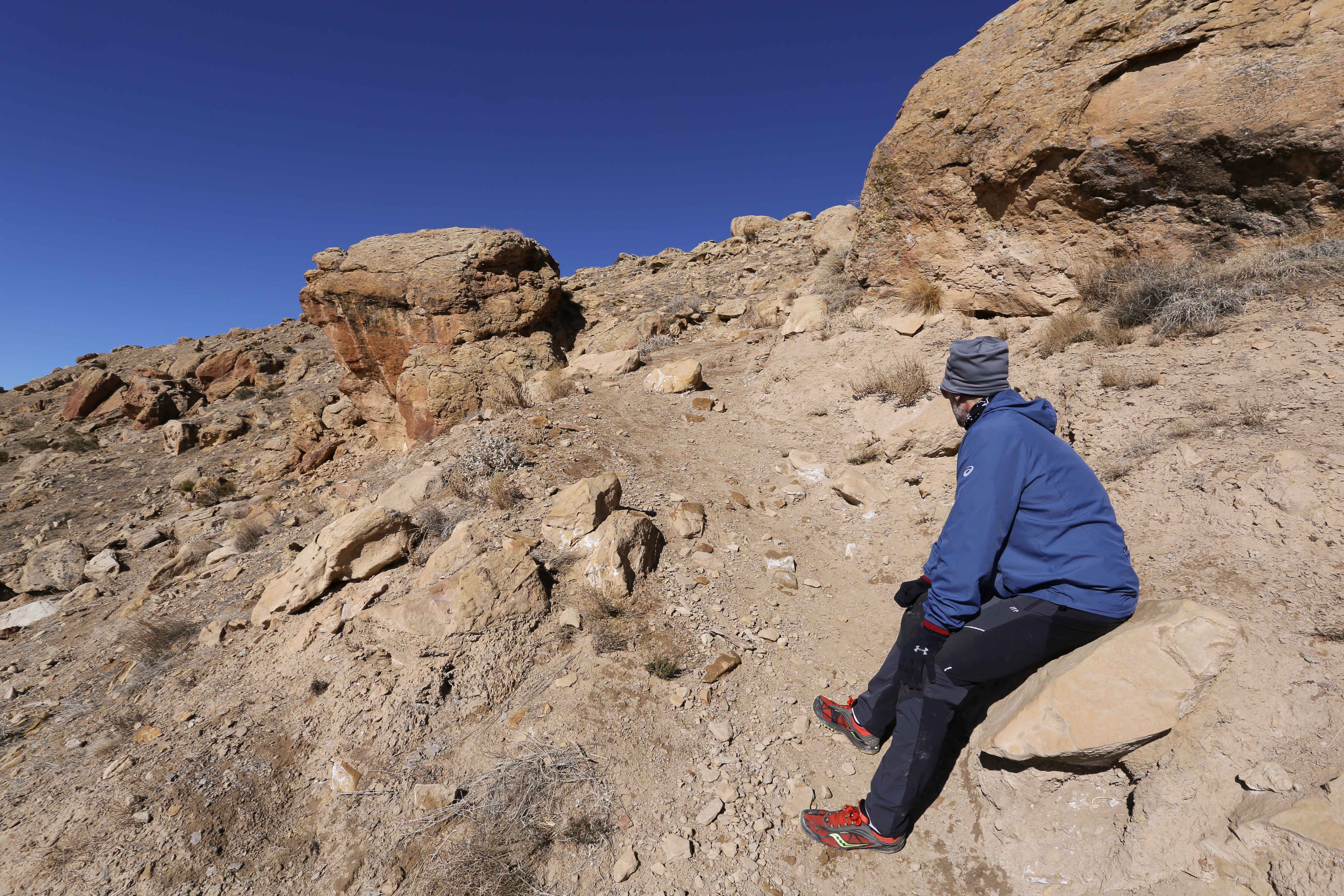
The second boulder field was as steep as the first and had many competing lines. We did our best to stay on the path but there really wasn’t a specific trail to follow. Although this section was steep it didn’t take long before it was over and we came upon a second meadow.
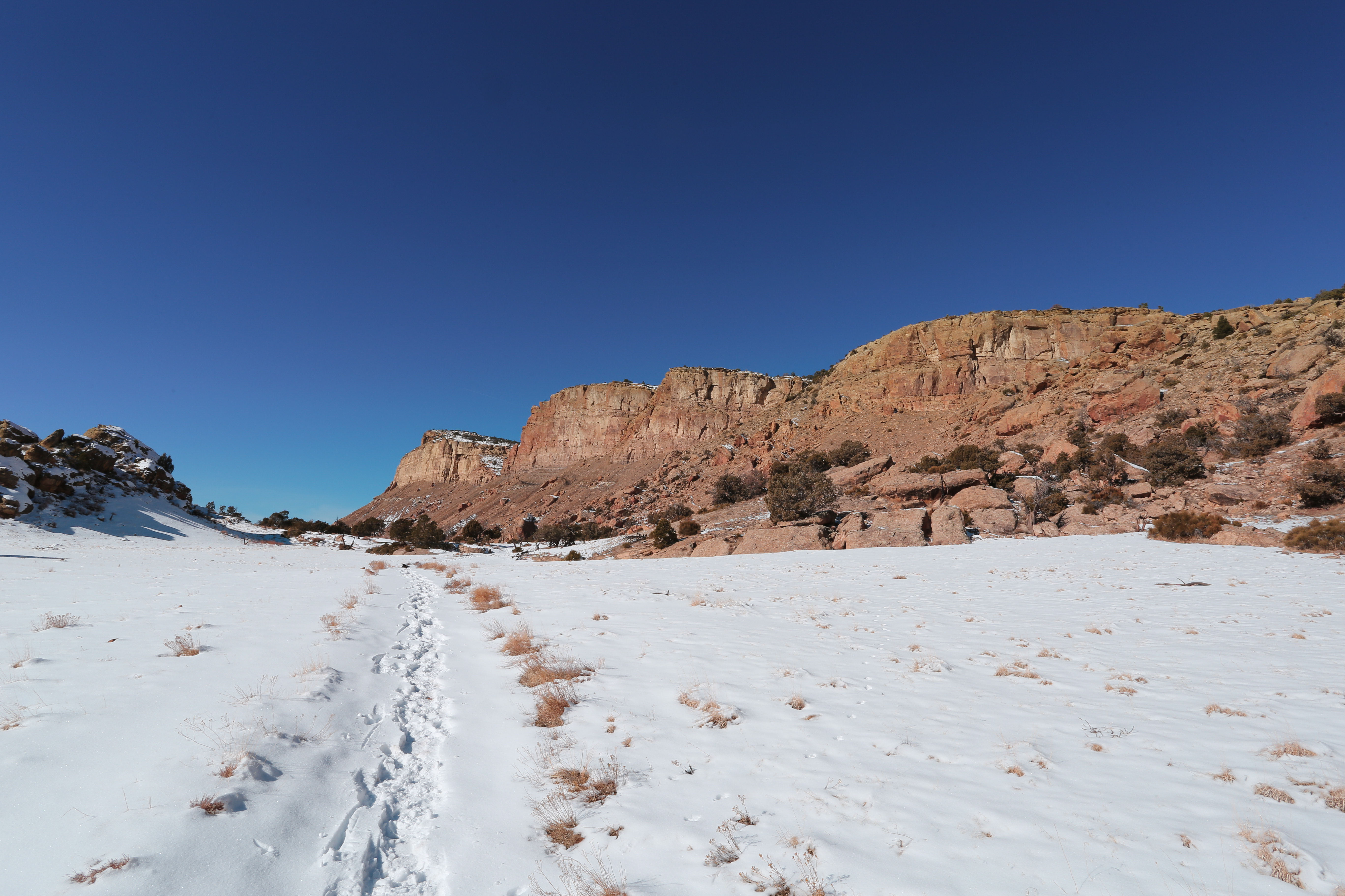

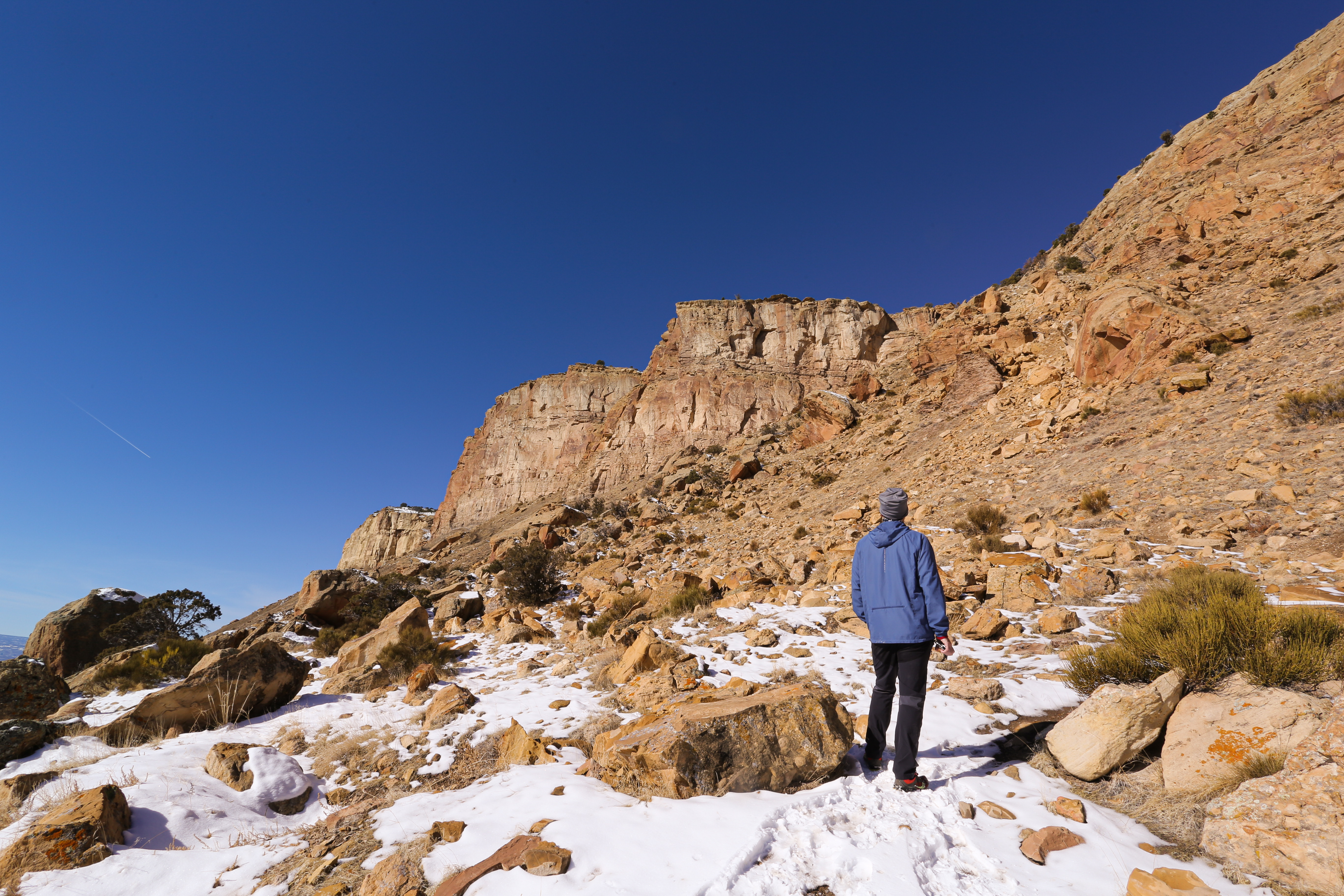
Unlike the first meadow this one was covered in a in a blanket of snow. Luckily it wasn’t too deep and we had no trouble walking through it. An interesting fact about this trail is that it sits in the Little Book Cliffs Wild Horse Area. A 36000-acre range set aside specifically to protect wild and free-roaming horses. Apparently these wild horse hang out in these meadows but the only trace we saw of them were a couple of stud piles.
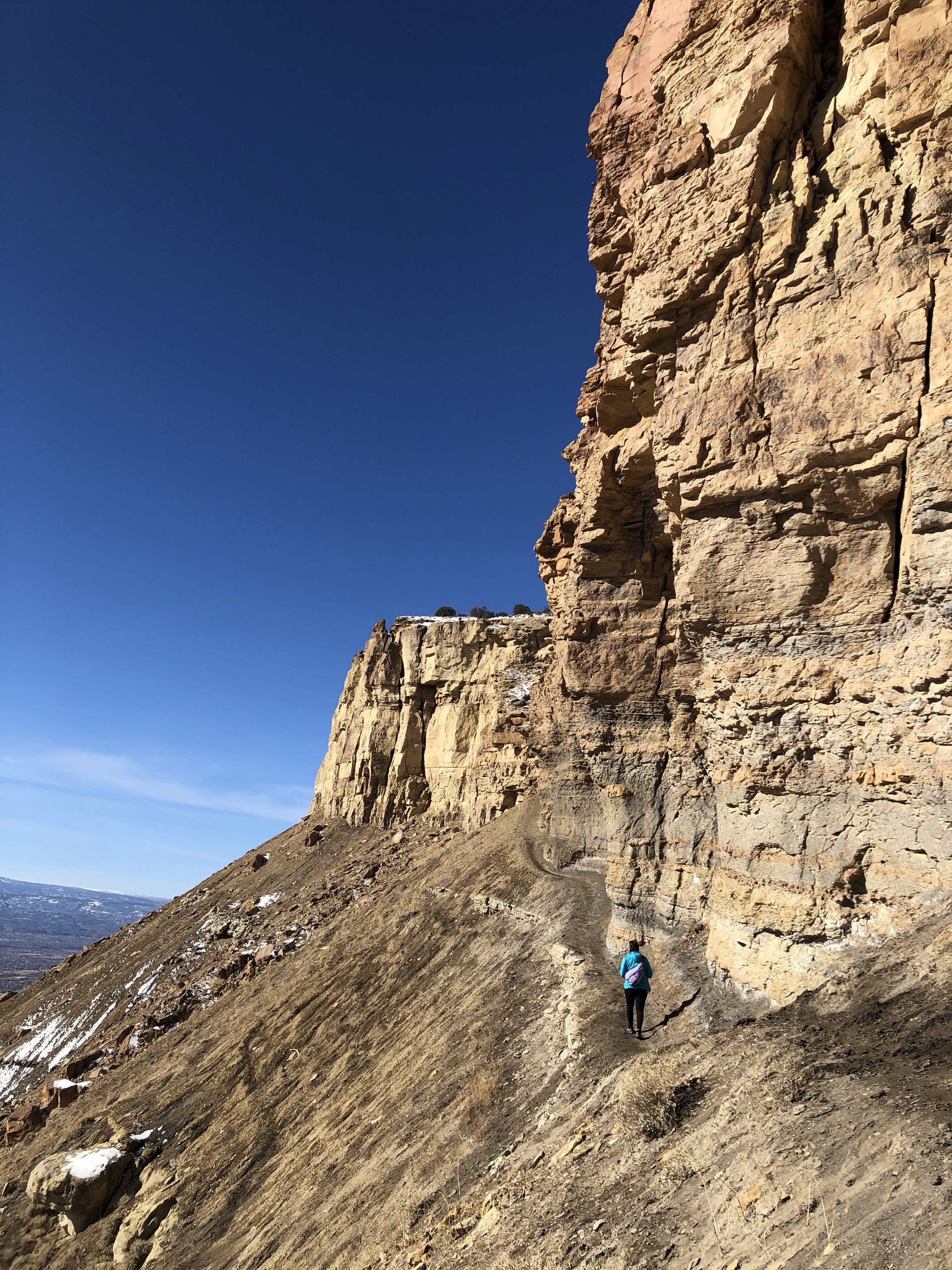
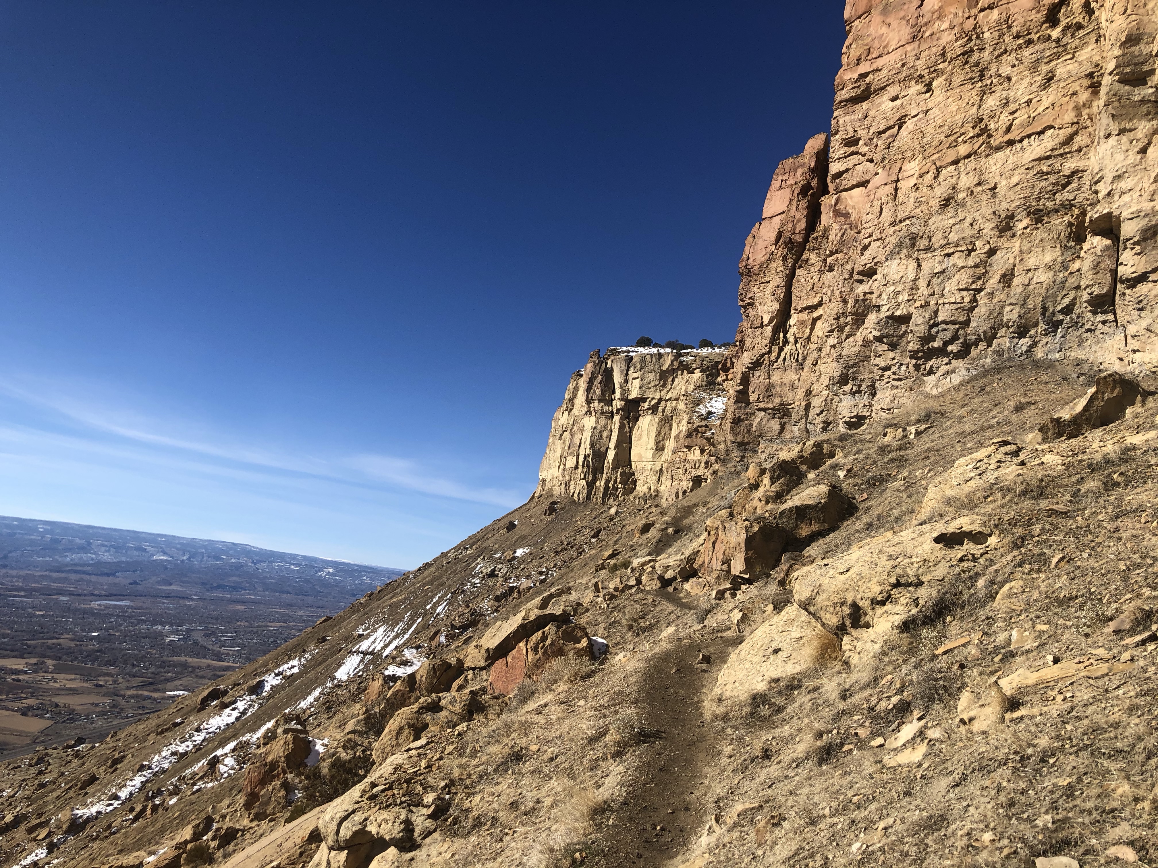

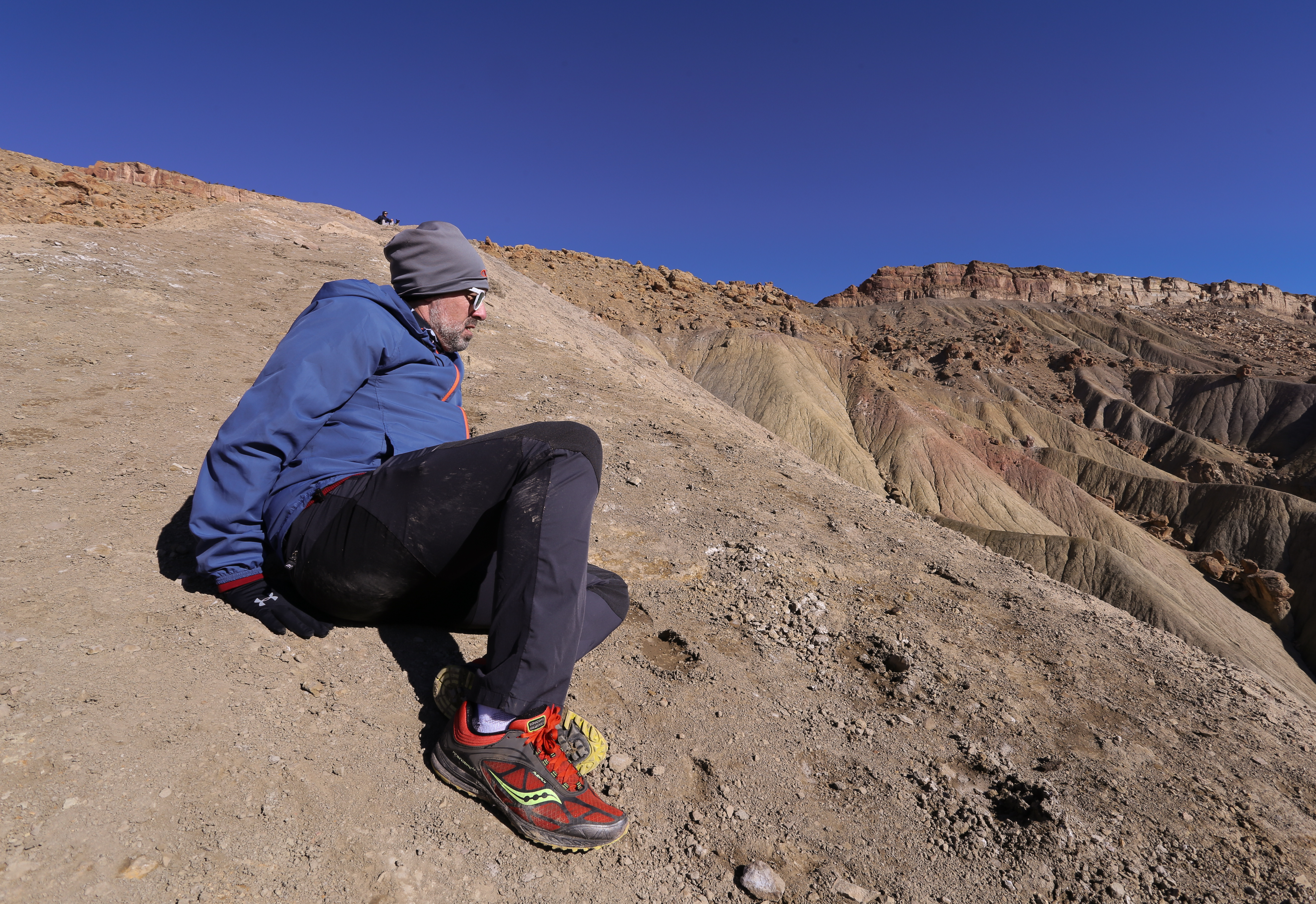
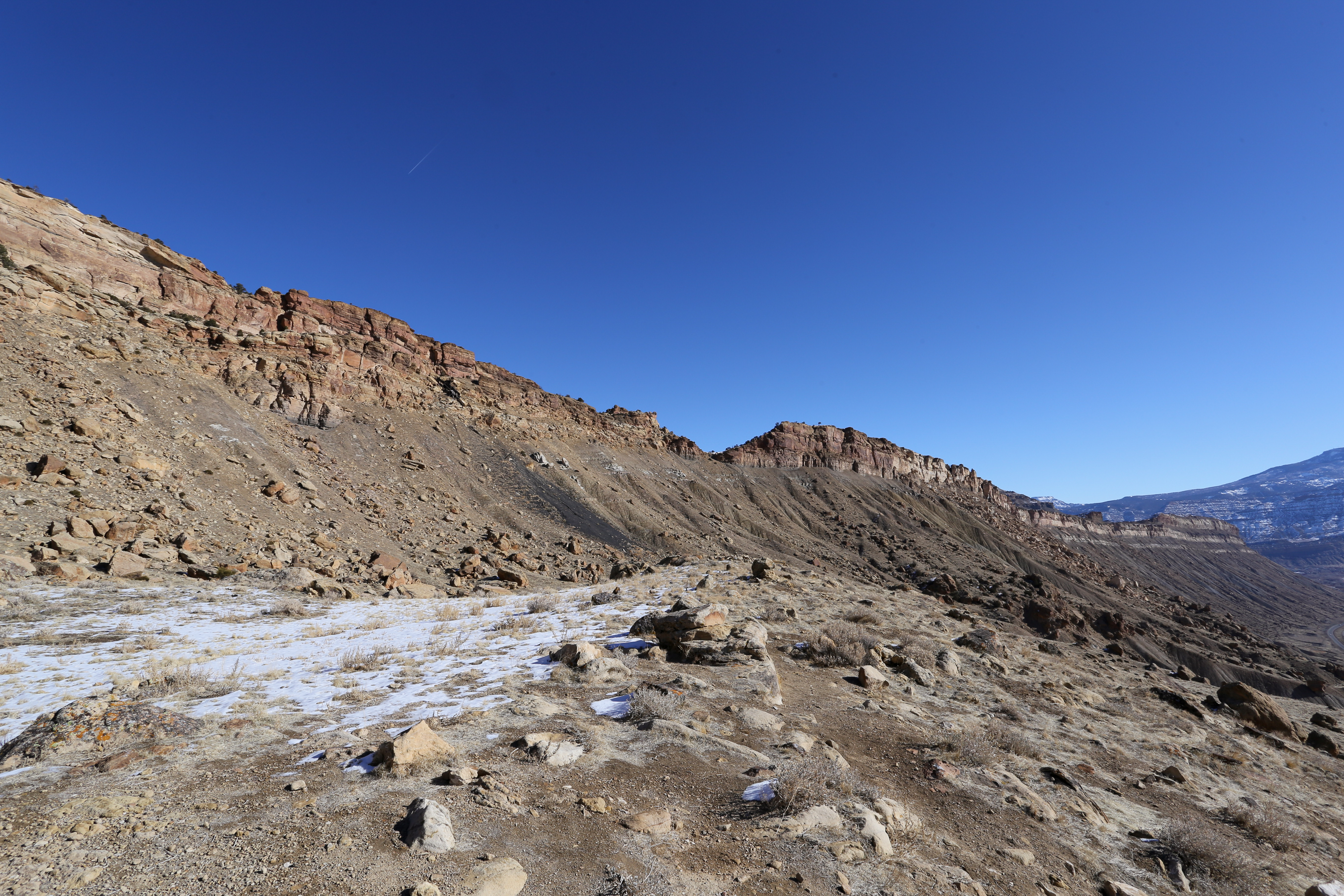
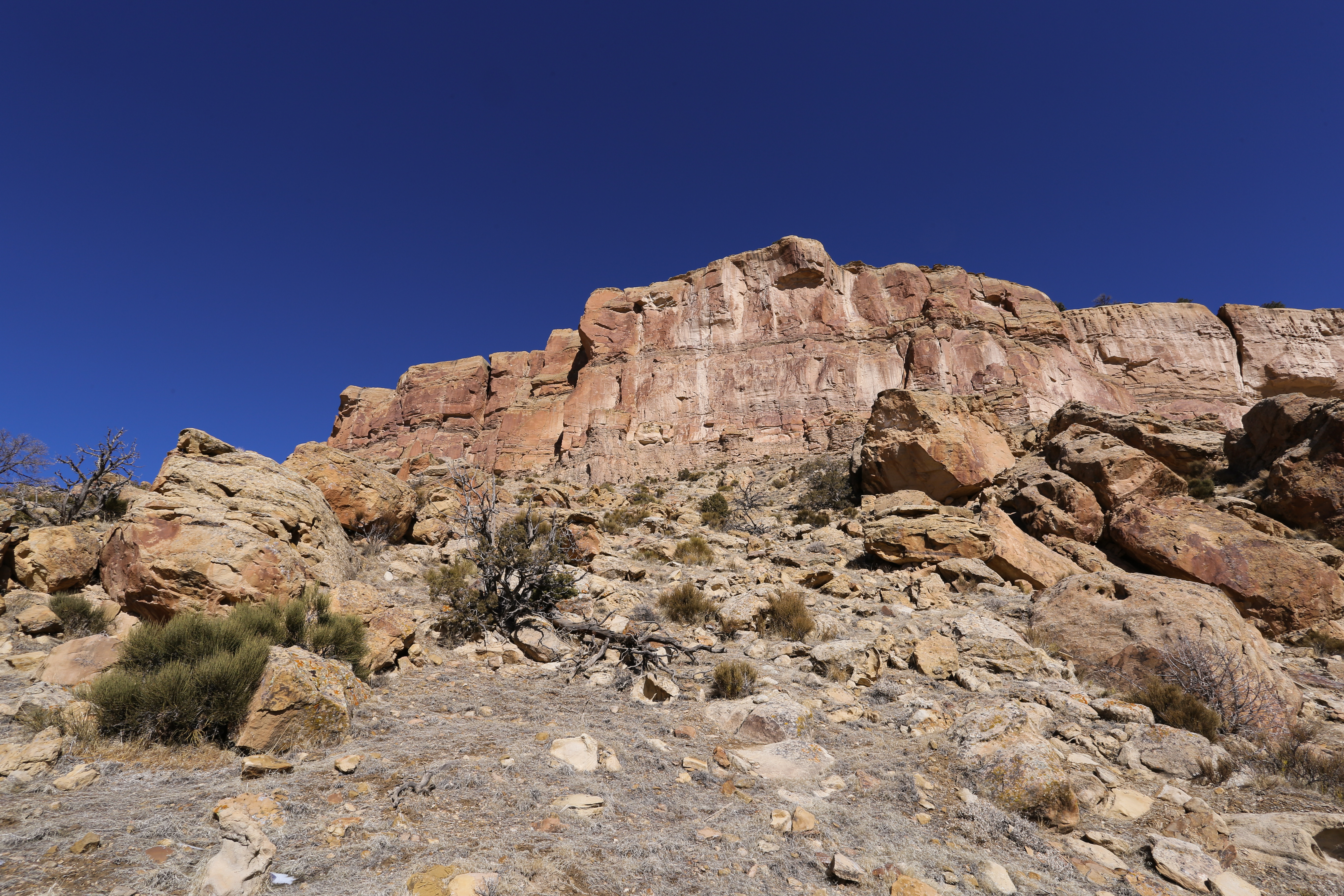
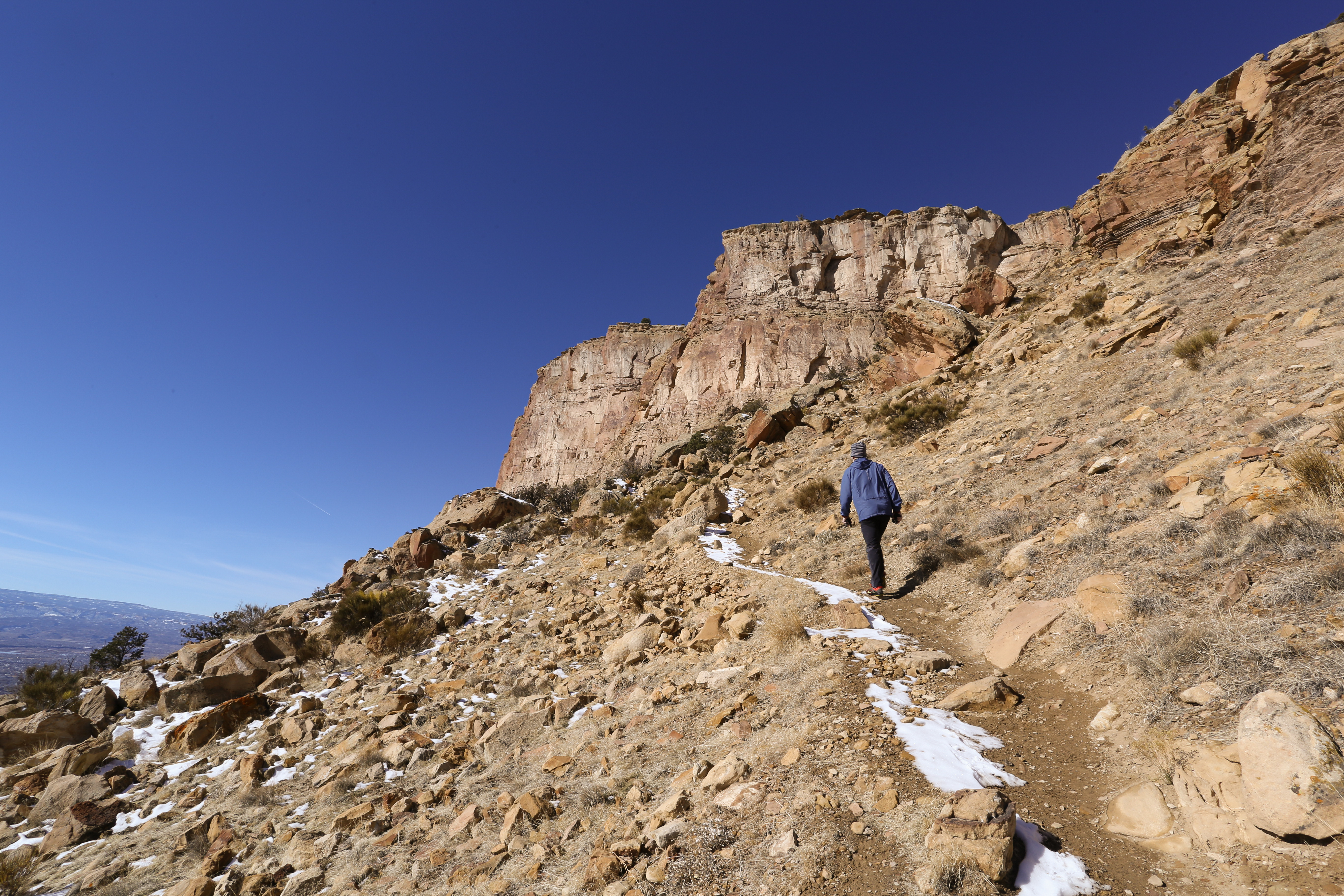
As we headed out of the second meadow the trail began to gradually ascend towards a massive cliff-line We soon found ourselves hiking along the base of these towering cliffs with the steep slope of the Book Cliffs only a foot away. This section of the trail was breathtaking and exhilarating; it was definitely my favorite part of the entire hike. At the end of the cliff-line the trail makes it way towards the final climb of the hike.
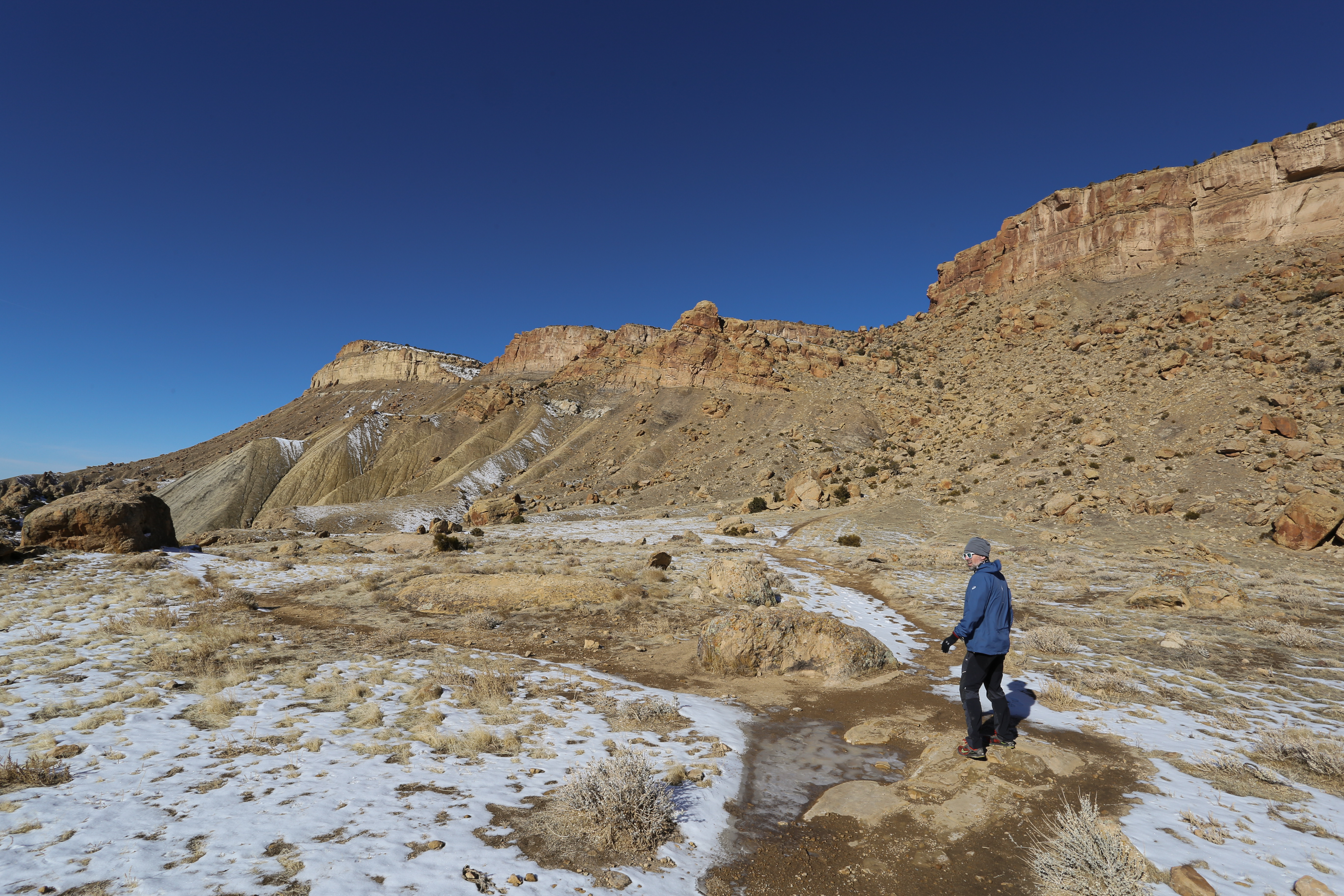
The saddle on the east side of Mount Garfield is steep and the trail was hidden under a deep layer of snow. This was by far the most difficult section of this hike. At one point I wasn’t sure if we were going to make it and was ready to turn around. We tried to find the path of least resistance but struggled to get our footing on the slippery rocks. We were less than a half a mile from the summit so with a little bit of determination we clambered our way up.
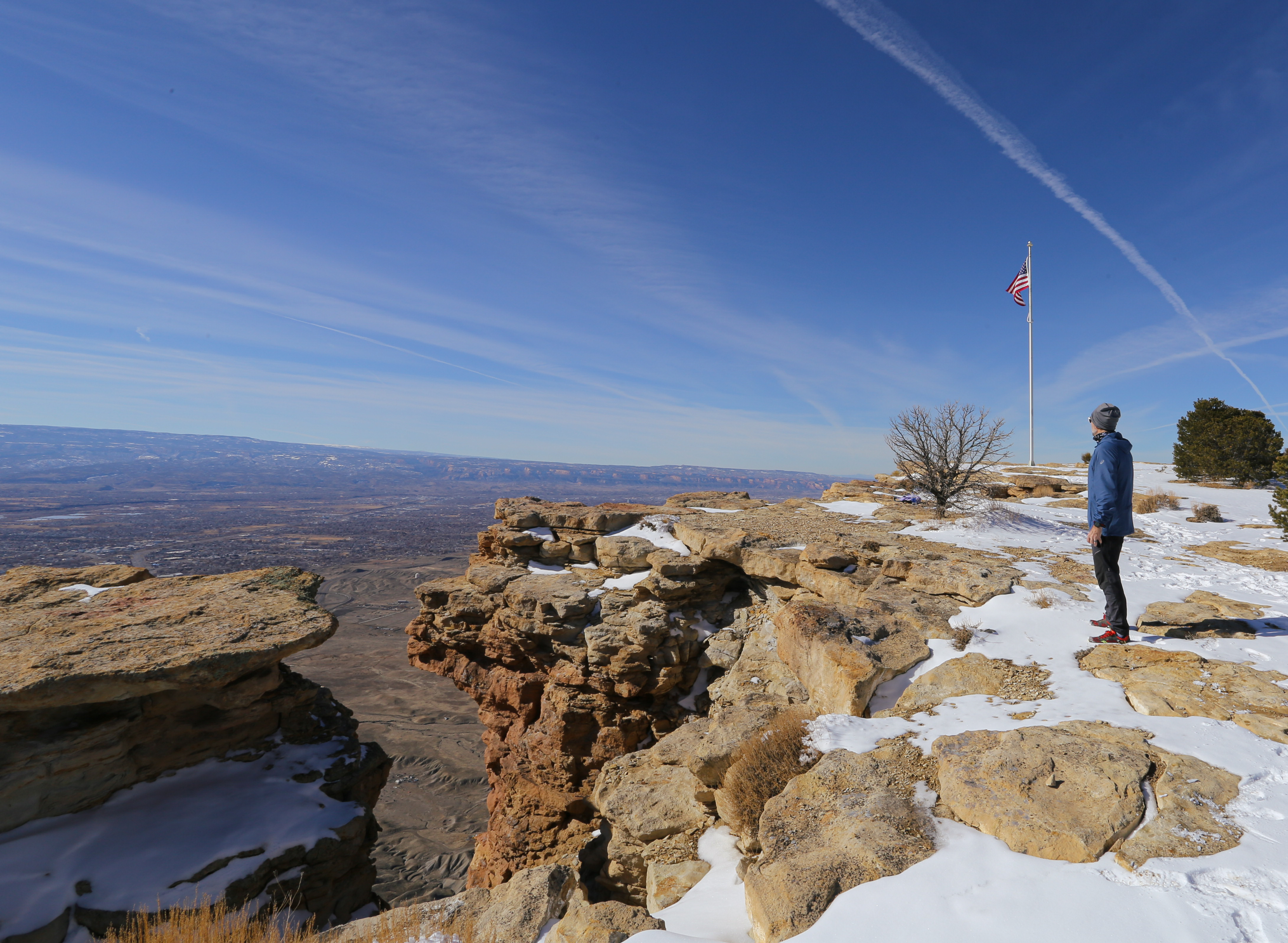
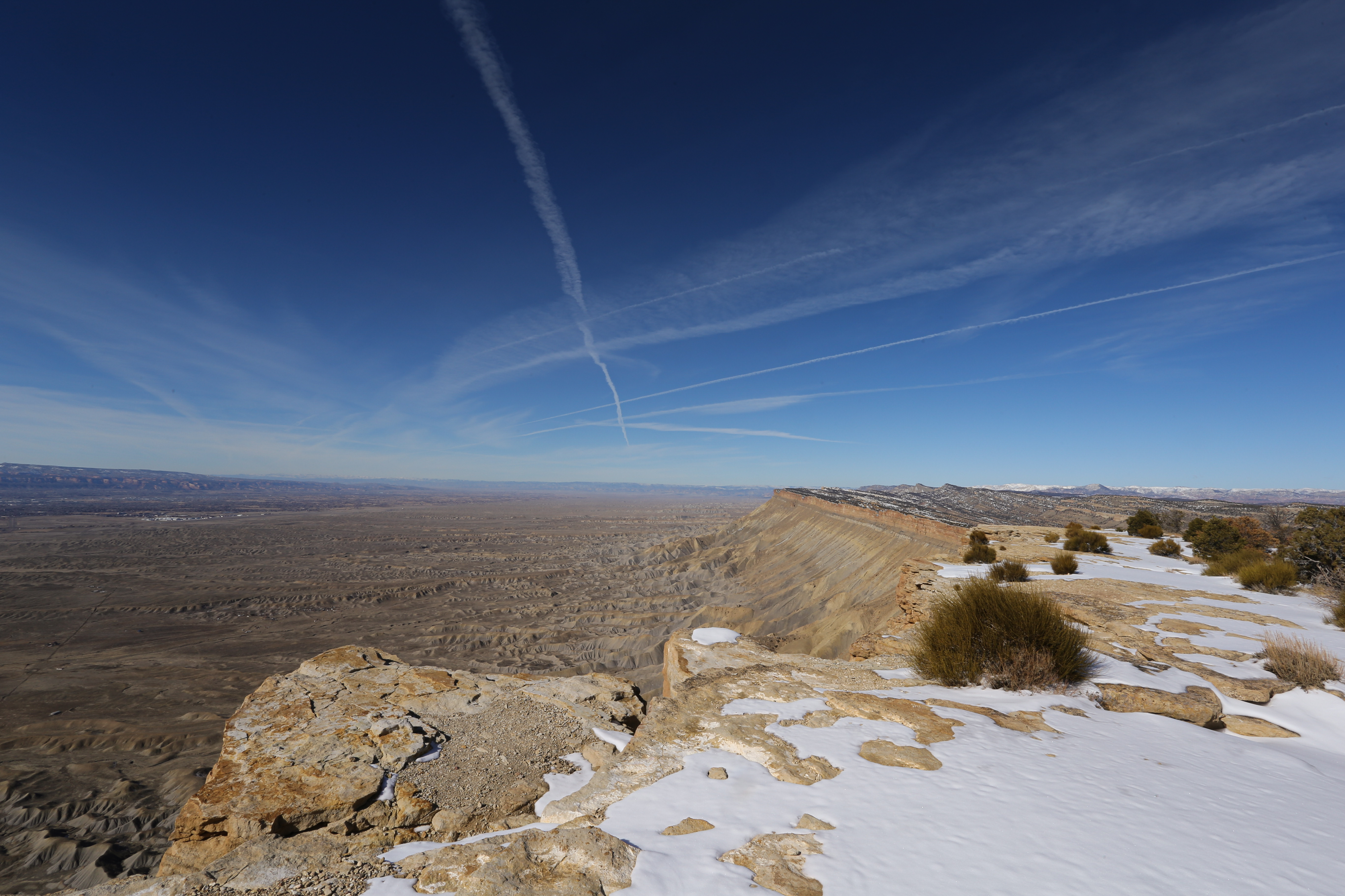
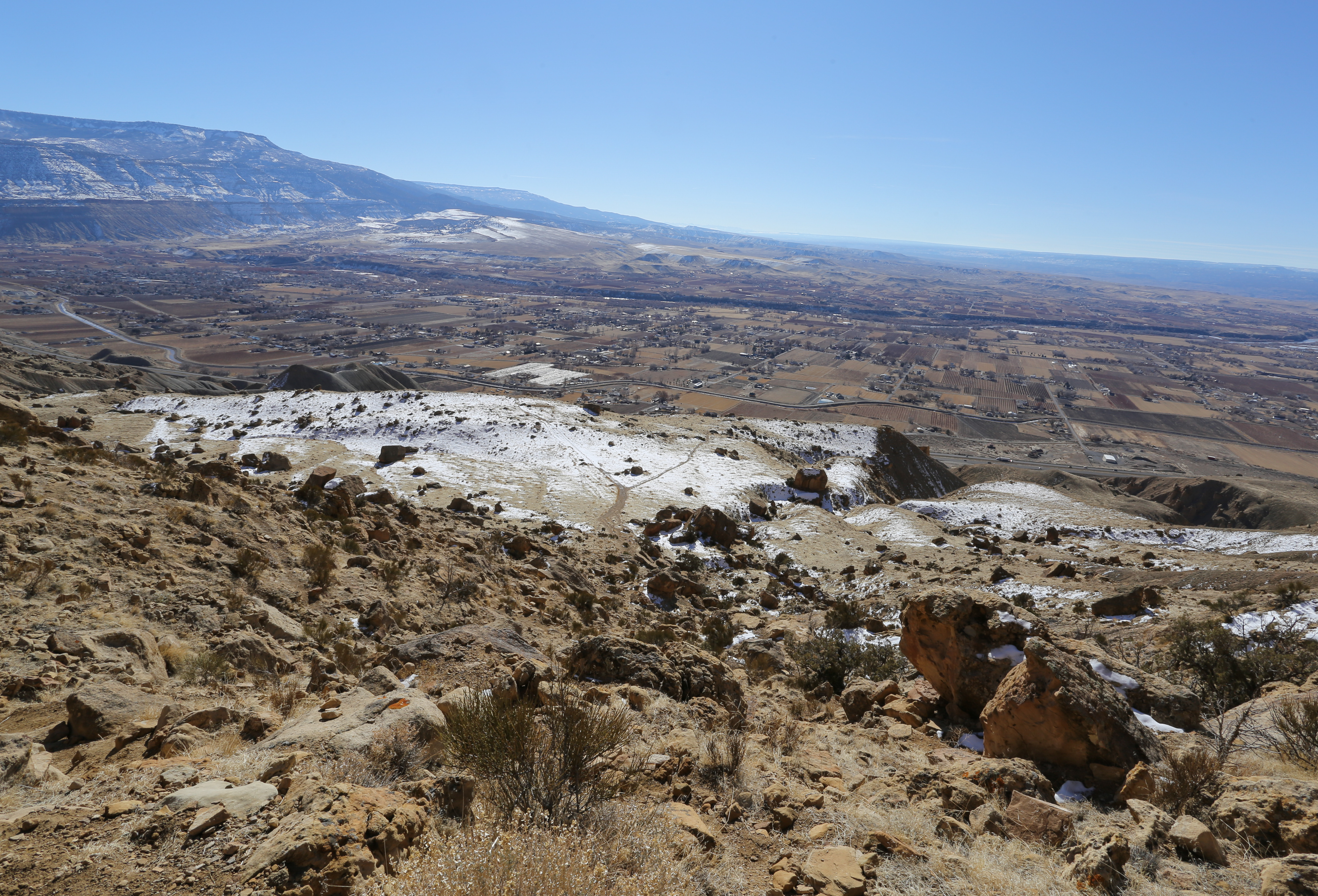
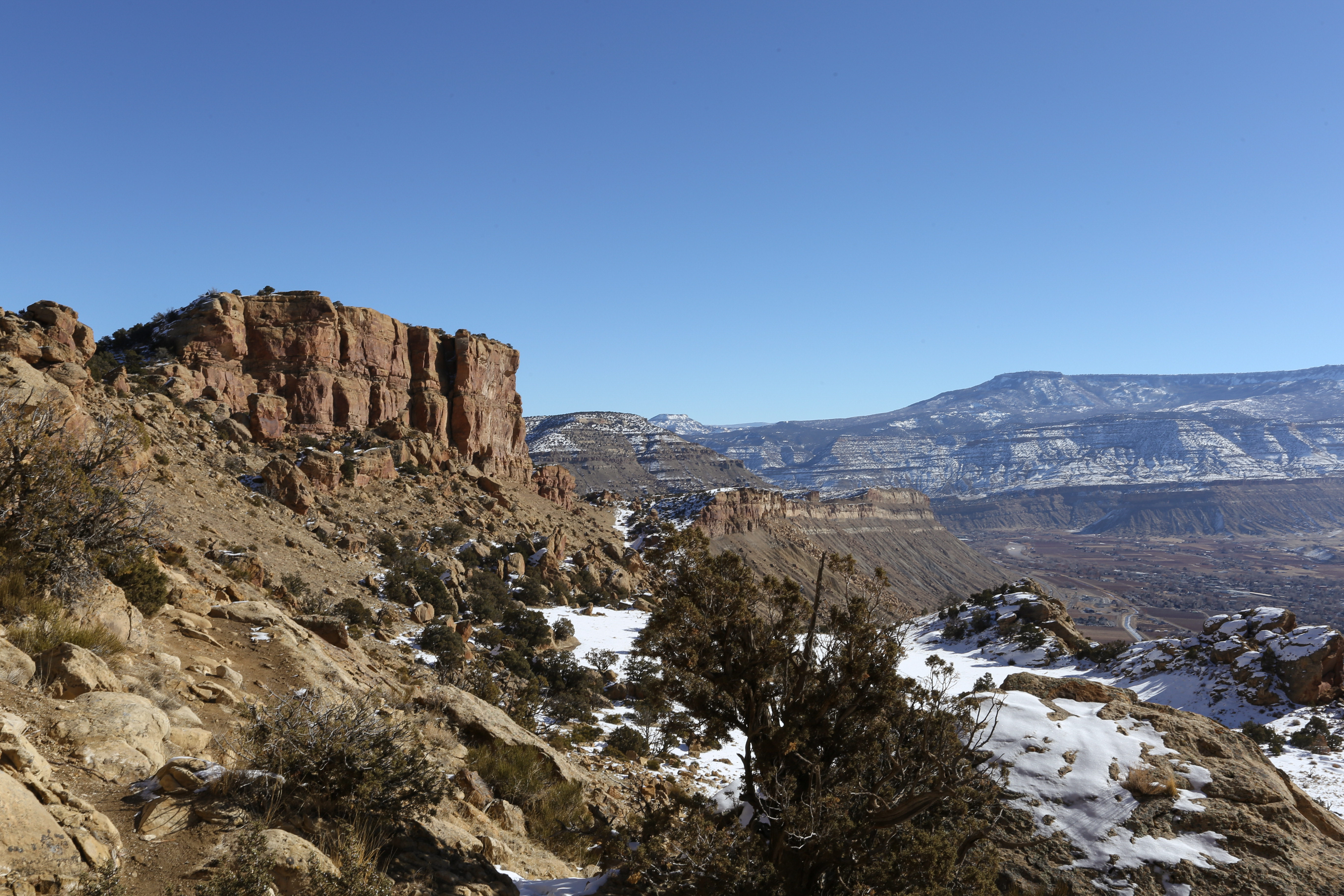
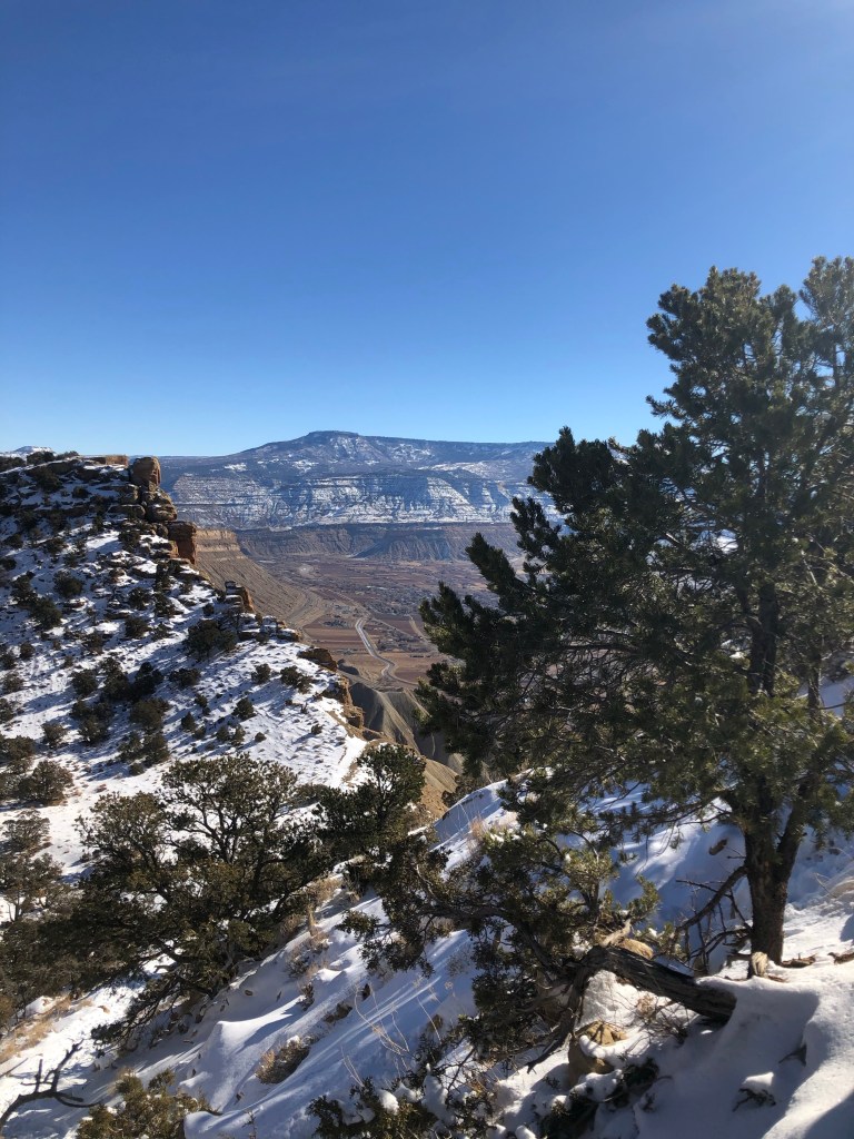
After a little trail and error we finally found ourselves on top of the mesa. At this point the trail was easy to spot as it followed the rim. We reached the summit, marked by an American Flag, in just under 2 hours. With clear blue skies we were able to see for miles, the view of the Book Cliffs to the North were absolutely incredible. Upon reaching the summit I would give this hike 5/5 stars; the scenery and the the views made up for the strenuous climb to the top.