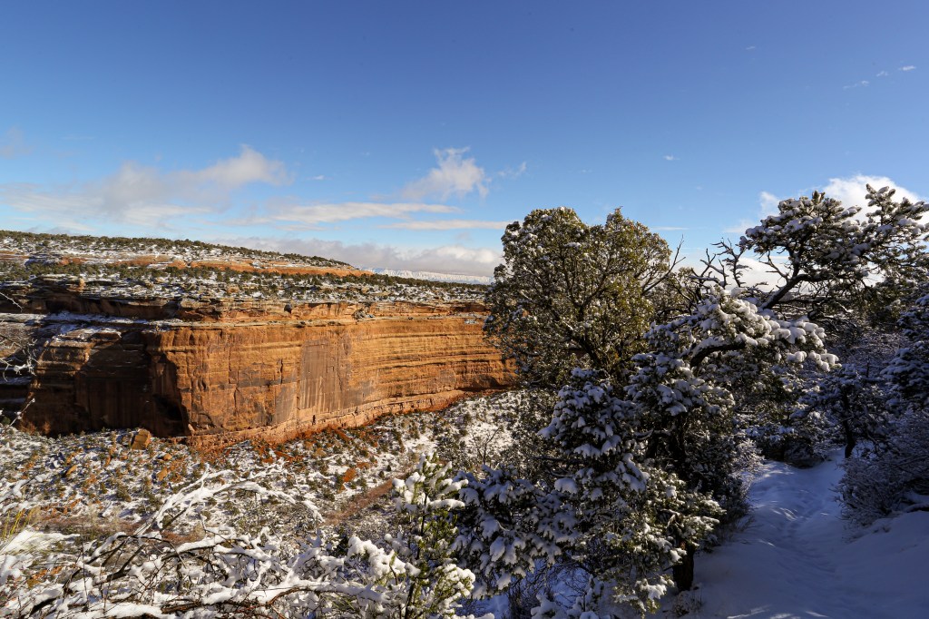
Before our trip to Grand Junction I knew nothing about the Colorado National Monument. Spanning over 20,000 acres the monument was established in 1911 by President William H. Taft. The history of the monument is as impressive as the geological formations that encompass this area. We spent a day in late January following the historic Rim Rock Drive and taking in a couple hikes.
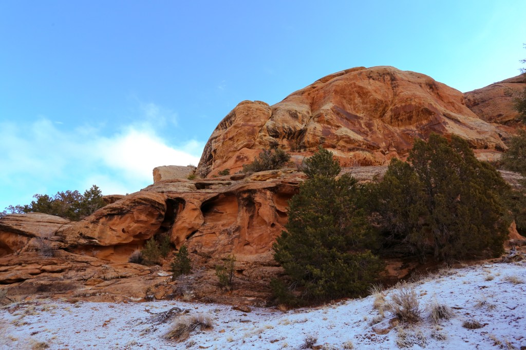
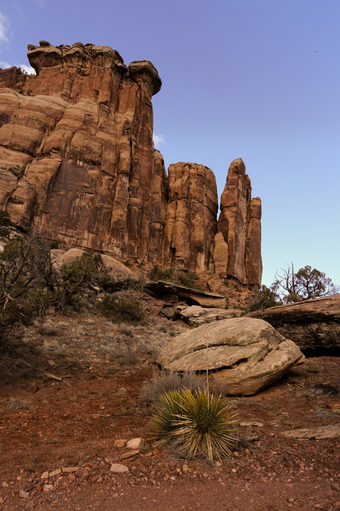
We began our day with a short hike up to Devils Kitchen. This 1.5 mile out and back is an easy hike up to an incredible rock formation that assembles into a natural amphitheater.
The beginning of the trail to Devils Kitchen is well marked and easy to follow. There are a couple of junctions to other trails (Old Gordon Trail & No Thoroughfare Canyon Trail) so be sure to follow the signs to Devil Kitchen.
The first half a mile of the trail is wide, flat and sandy. As the trail begins to climb the boulders that make up Devil Kitchen can be seen above. Although the trail was covered with a light dusting of snow we were able to find our way without too much trouble.
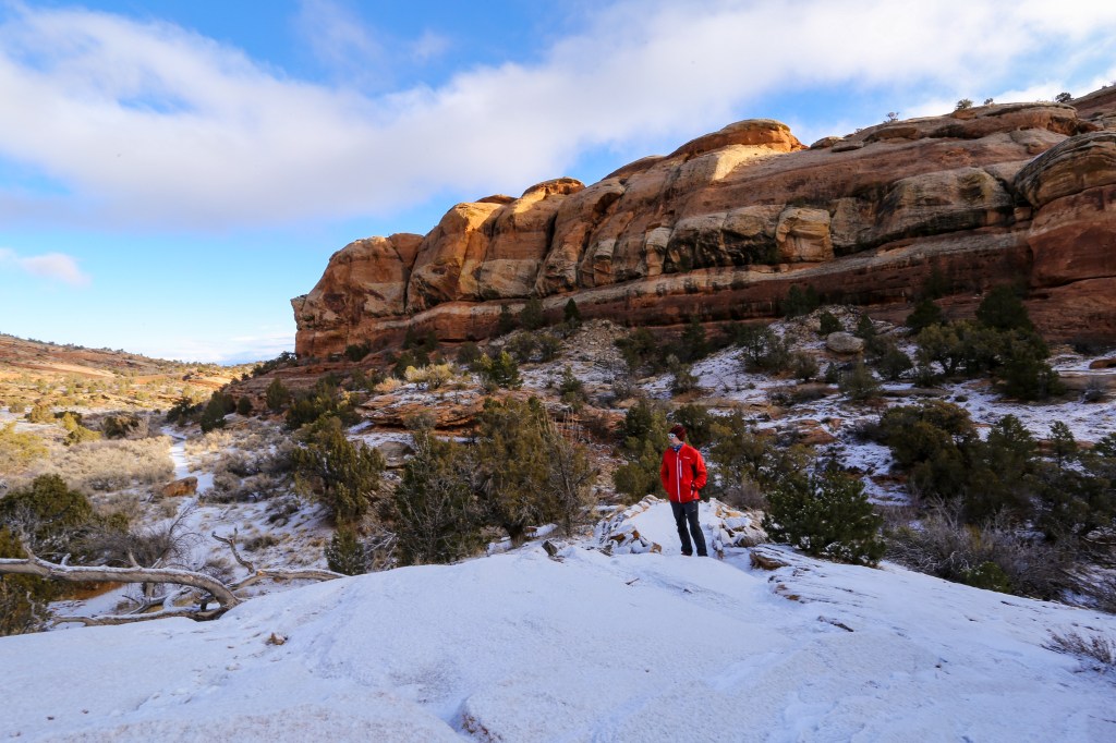
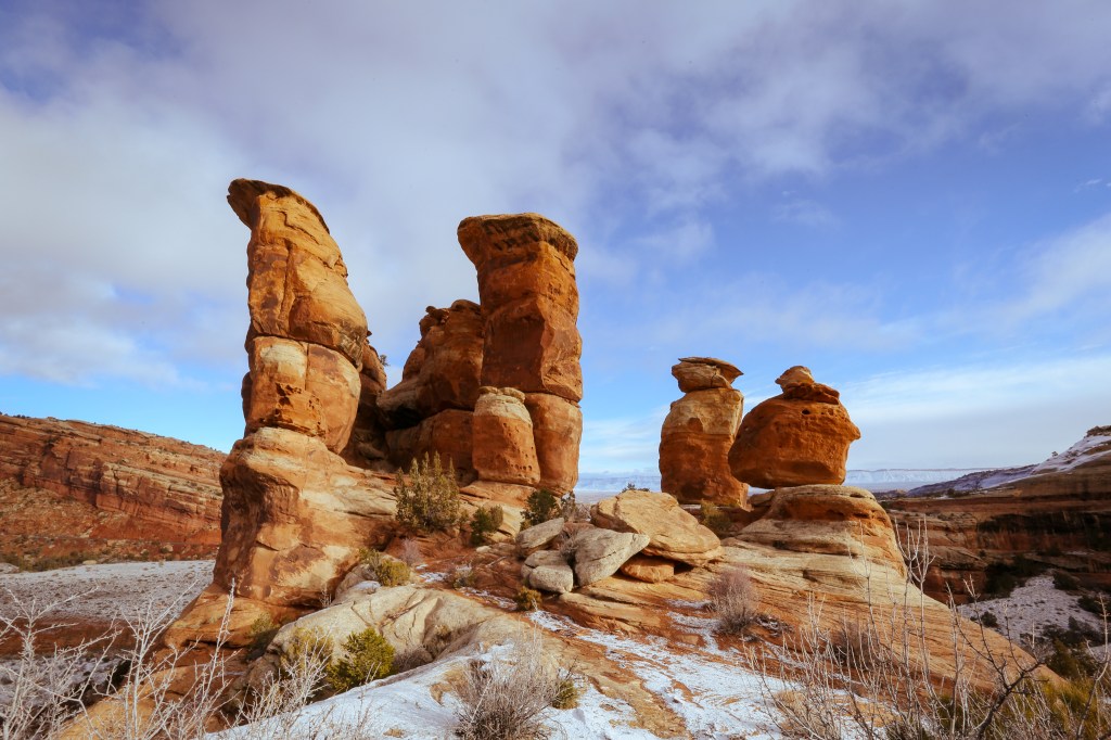
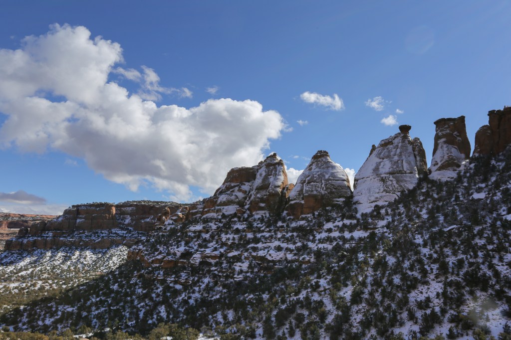
The large rock grotto that makes up Devils Kitchen is well worth the short hike. According to NPS.gov the boulders that make up Devils Kitchen are composed of Wingate Sandstone capped by a thin remnant of the erosion-resistant Kayenta Formation, both from the Early Jurassic period. Wingate Sandstone is the oldest formation in the Glen Canyon Group, a geological group of formations spread across the United States of Nevada, Utah, northern Arizona, north west New Mexico and Western Colorado. The Winggate formation is estimated to be approximately 200 million years old!
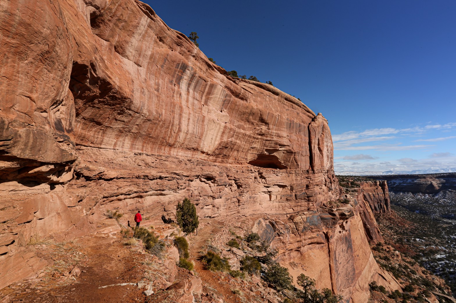
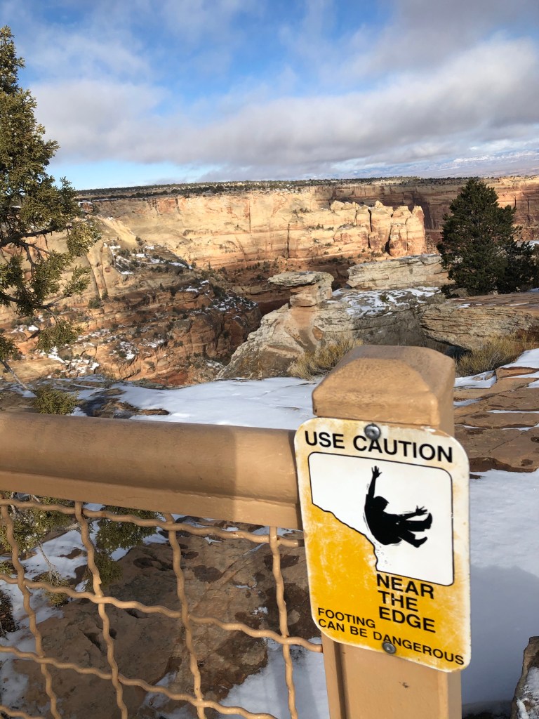
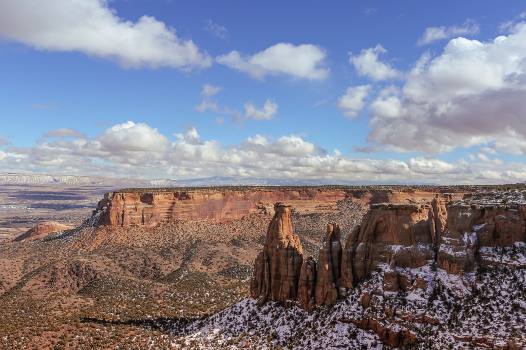
After leaving Devils Kitchen we proceeded along Rim Rock Drive. A 23 mile incredibly engineered road that follows the rim of the plateau. Driving along this historic route is exhilarating to say the least. With low guard rails and sheer drop offs, this road is not for the faint at heart, let’s just say I’m glad I was the navigator on this trip.
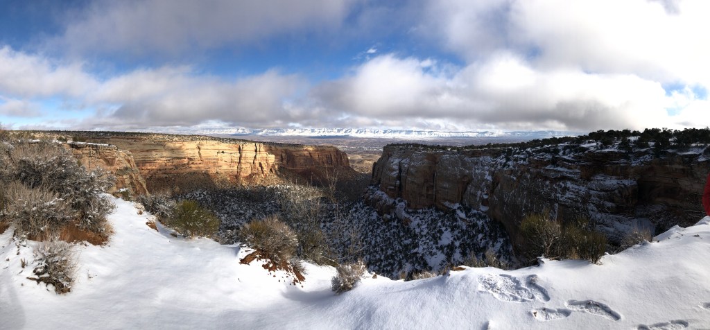
Built in the 1930s by the Civilian Conservation Corps as a Public Works Project, Rim Rock Drive offers 19 overlooks and numerous trail heads. Our first stop after leaving the Devils Kitchen Trailhead is Cold Shivers Point. Sticking with the theme of sheer drop offs and exhilarating moments this viewpoint takes you right out to the edge of the cliff. Even though we were inside the rail, the drop on the other side was enough to send cold shivers down my spine. I guess that’s why they call it Cold Shiver Point!
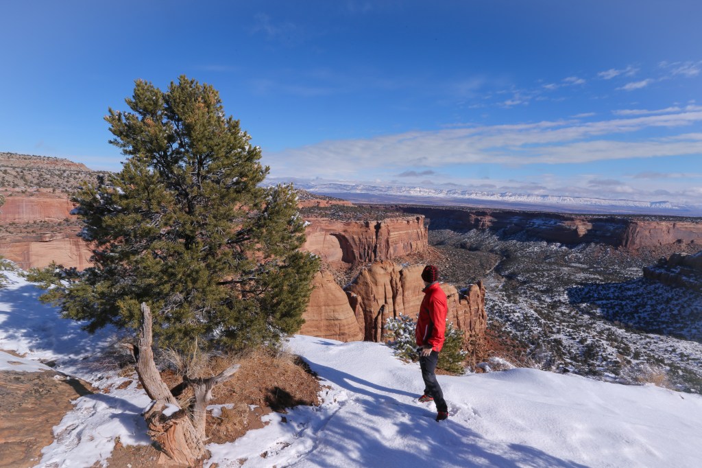
Continuing along the edge of the plateau via Rim Rock Drive, we made our way towards Fruita. We didn’t have much of a plan but we knew we wanted to get one more short hike in before the day was through. After examining the map we thought a good place to hike would be the Ute Canyon Trail. After arriving at the trail head, and assessing the trail, we decided against doing this hike. From what we read the beginning of this trail is pretty steep and being late January the trail had quite a bit of snow cover. We didn’t want to put ourselves in any danger, so after taking a couple photos we jumped back in the car and moved on.
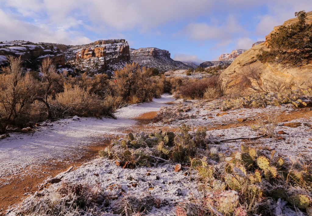
A few miles down the road we found the Monument Canyon Trailhead. This trail begins on the north side of the canyon making the snow cover not as big of a factor. We decided to head down the trail and made a pact that if it became to treacherous we’d turn around.
Monument Canyon trail is an out and back with both an upper and lower trailhead. The trail is 6 miles one way and from what I’ve read it is one of the most popular trails in the Monument. From the upper trailhead the trail switchbacks its way down the canyon dropping 600 feet in the first thee quarter of a mile.
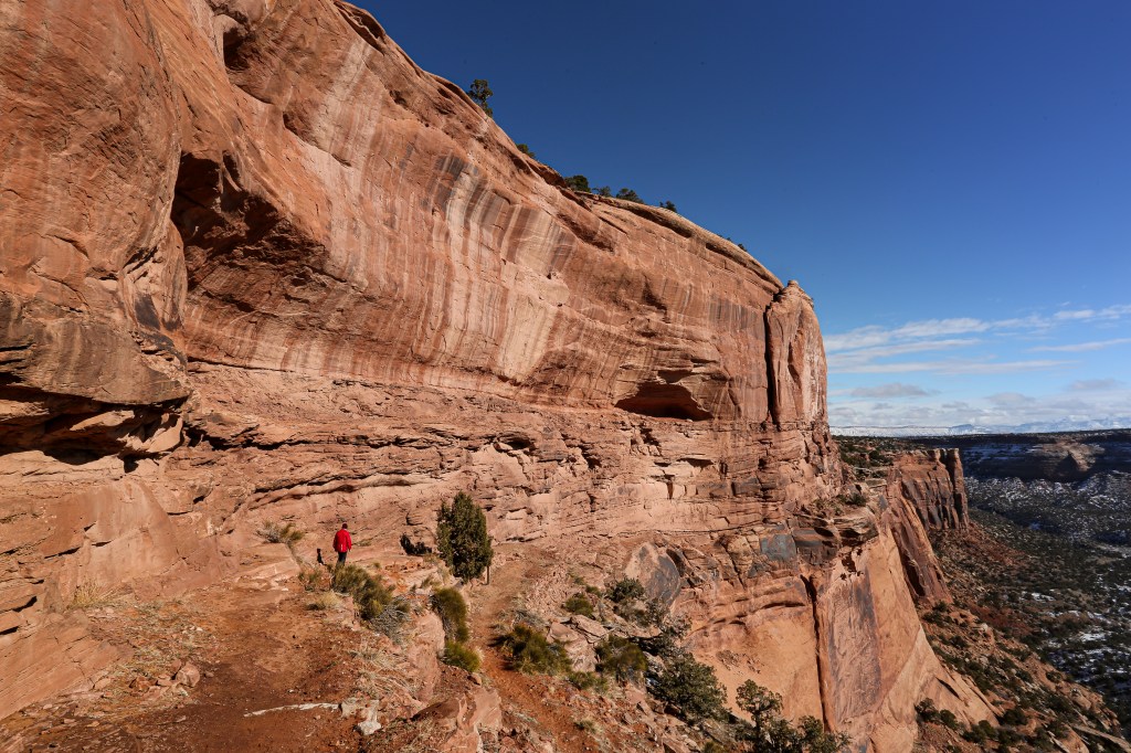
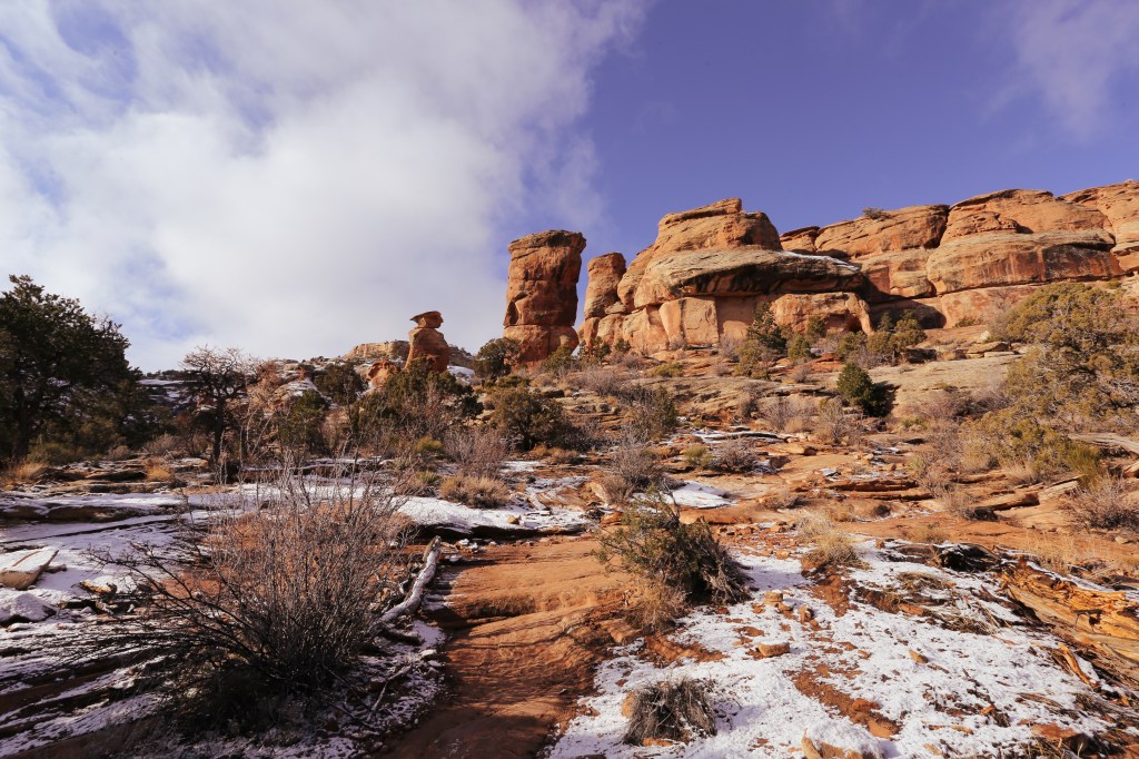
As we made our way down the canyon we also had an incredible view of Cokes Oven to the south. This formation is named after the dome-shaped ovens that were once used to produce fuel coke from coal. According to NPS.Gov,Cokes Cokes Oven is an illustration of the effects of time and weather on the Wingate Sandstone.
Once you reach the floor of the canyon you will cross a washout as the trail levels out. From here we continued another mile towards Independence Monument. At the 2 mile mark we decided to turn around as it was getting late and we wanted to make it back to Fruita before dark. If we would have continued we would have reached Independence Monument just another mile down the trail.
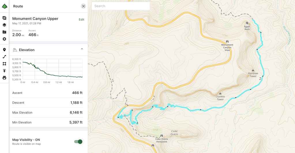
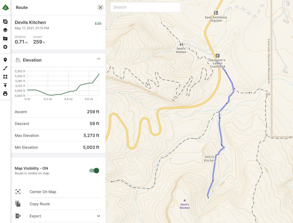
Monument Canyon Upper, Gaia GPS
Our day spent in the Colorado National Monument was nothing short of amazing. The landscape, the geology, the history, I loved all of it. We will definitely be back when we have more time to explore this magnificent treasure.
Sources:
~https://www.nps.gov/colm/learn/nature/wingate-sandstone.htm
~https://www.nps.gov/colm/planyourvisit/short-hiking-trails.htm
